Styling
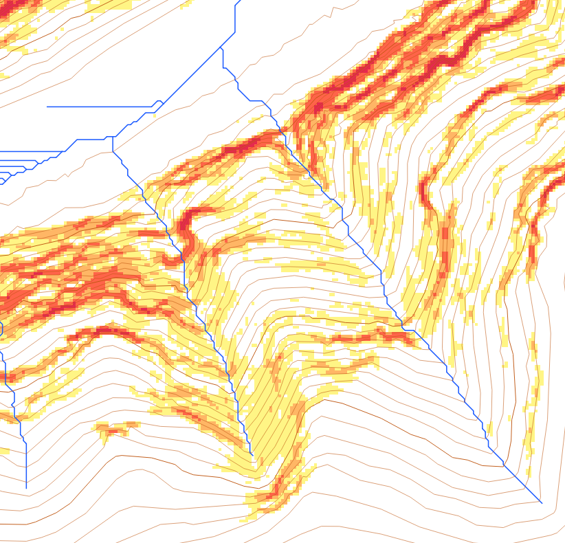
Here are a series of simple QGIS style files that I use to style basic topographic maps:
- Contours (vector) - 5m_contours_scale.qml - 5m contours with 50m index contours. More detailed contours are only shown as you zoom in, keeping the map less cluttered.
- Streams (vector) - basic_watercourse.qml - a very basic styling for vector watercourses
- Slopes (raster) - slope_cliffline.qml - gradient colouring of slopes from 40 to 90 degrees to depict clifflines
Other styles
- Slopes (categorised raster) - slope_cliffline_category.qml - if you categorise your slope raster as described in Slopes then you will need this variation of the slope style
- OSM Points (vector) - osm_bw_points.qml - for use with OSM data
- OSM Lines (vector) - osm_bw_lines.qml - for use with OSM data