This is an old revision of the document!
Table of Contents
Managing large DEMs
Intro
While data can be downloaded in an ad hoc manner, if you are regularly processing DEMs, it is better to have the DEM tiles already downloaded.
Once downloaded, pre-process the tiles into GeoTIFFs, build a virtual raster for each 1:100k grid square. You can then build a virtual raster of virtual rasters!
Downloading data
Download tiles by 1:100k map area, which is 0.5 x 0.5 degree squares. Each 1:100k map area ranges from around 2GB to 6GB of data, depending on the number of 2m DEMs vs 1m DEMs, and other factors.
The Sydney basin and Blue Mountains is around 50GB all up.
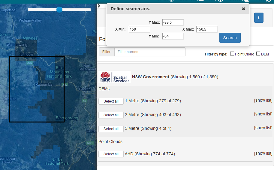
For example, to request data from ELVIS for the Katoomba 1:100k map area (bounded by -33.5,150,-34,150.5), see the screenshot below, and Select All DEMs:
For reference, below are the 1:100k map areas around Sydney:
| 8833_gulgong | 8933_merriwa | 9033_muswellbrook | 9133_camberwell | 9233_dungog | 9333_buladelah | 9433_forster |
| 8832_mudgee | 8932_mt_pomany | 9032_howes_valley | 9132_cessnock | 9232_newcastle | 9332_port_stephens | |
| 8831_bathurst | 8931_wallerawang | 9031_st_albans | 9131_gosford | 9231_lake_macquarie | ||
| 8830_oberon | 8930_katoomba | 9030_penrith | 9130_sydney | |||
| 8829_taralga | 8929_burragorang | 9029_wollongong | 9129_port_hacking | |||
| 8828_goulburn | 8928_moss_vale | 9028_kiama | ||||
| 8827_braidwood | 8927_ulladulla | 9027_jervis_bay |